Why Estuary Logistics Make or Break a South West Trek
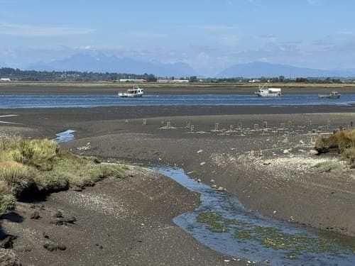
Along the South West Coast Path, estuaries are more than attractive interruptions in the coastline. The Dart, Erme, Avon, Yealm, Fal, Helford and numerous smaller tidal inlets form natural gateways between headlands, villages and ferry landings. They also create some of the most consequential logistical points on a long-distance walk. A stage that looks straightforward on a map can become several miles longer when a ferry is not running, a footpath is flooded, or a tidal crossing has been misjudged.
The common mistake is to treat a ferry symbol or river crossing as a fixed checkpoint. Ferries do not necessarily run continuously, every day, or on the same timetable throughout the year. Services may be seasonal, demand-led, tide-dependent or vulnerable to fog, wind and swell. A reliable itinerary therefore combines the tide table, the operator”s current information, the weather forecast and a realistic inland alternative. For route planning resources and practical walking support, a coastal walking holiday guide can help place individual crossings within a manageable daily stage.
Reading the Tide Tables for Estuary Crossings
Most UK coastal locations experience two high tides and two low tides during a roughly 24-hour period. Because the lunar day is longer than the solar day, successive high tides usually arrive about 50 minutes later each day. The interval between high and low water averages approximately 6.25 hours, although local geography can make the timing and speed of the flow markedly different from one estuary to the next. A tide table for a nearby beach is not automatically suitable for a river mouth several miles away.
Spring tides occur around the new and full moon and produce a greater vertical range between high and low water. On these days, sandbars, causeways and fords may be exposed for only a short period, then covered rapidly by deep water. Neap tides, around the first and third quarter moon, generally have a smaller range and gentler movement, but they do not make every crossing safe. Wind direction, atmospheric pressure, rainfall and the shape of the channel can all alter conditions. The tide guidance for walkers explains why estuaries, salt marshes and tidal rivers require the same care as apparently more obvious beach hazards.
Plan to reach any tidal crossing well before the predicted limit, not at the precise minute of low water. Around the River Erme, for example, the accepted walking window is generally about one hour either side of low tide, but local conditions determine whether that window is usable on a particular day. Watch the water rather than relying only on a printed time. A rising tide can enter side channels first, cutting off a route behind you before the main channel appears threatening.
- Check the date, time zone and tide height, including whether predictions are shown in British Summer Time.
- Use information for the nearest relevant location and allow for local differences at the estuary entrance.
- Leave tidal ground early, especially during spring tides, strong onshore winds or poor visibility.
- Never assume calm-looking water is weak water. Incoming currents can move quickly through narrow channels.
- Share the route plan and expected return time, carry a charged phone, and identify escape points before setting out.
HM Coastguard advises visitors to explore tidal areas while the water is falling and to identify all possible exits before the tide turns. Water above ankle depth should be treated with particular caution, especially where the bottom is uneven or the current is fast. If a walker becomes trapped, the priority is to reach safe ground if possible and call 999, requesting the Coastguard. Swimming across an estuary is not an alternative to waiting for a ferry or taking a detour.
Seasonal Ferry Realities Across Devon and Cornwall
South Devon contains five principal estuaries, and ferry services provide important links for Coast Path walkers across four of them. The pattern is mixed. Dartmouth and many Dart Estuary crossings operate throughout the year, while Salcombe to East Portlemouth is a dependable year-round passenger link with broadly more generous summer hours. By contrast, the Yealm and Avon passenger ferries are generally seasonal, commonly operating from 1 April to 30 September, with the Avon also subject to limited daily windows and, in some schedules, no Sunday service.
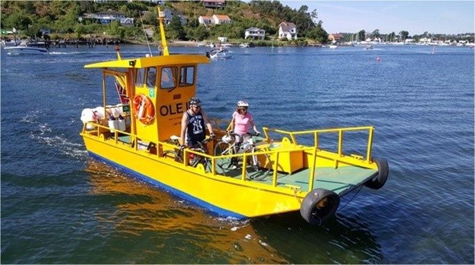
Even a listed operating season does not guarantee a sailing. Low water can prevent a boat reaching a landing stage, while fog, high swell, strong wind or mechanical problems may suspend a service at short notice. Public holidays and school-holiday demand can also alter hours. Check the operator immediately before walking the stage, and keep the telephone number available rather than depending on a timetable downloaded months earlier. The South Devon National Landscape specifically recommends confirming journeys because schedules can change with tides, weather and holidays.
| Estuary or crossing | Service season | Typical daily frequency | Operational notes |
|---|---|---|---|
| Dartmouth and Kingswear | Year round | Frequent shuttle services | Several passenger and vehicle ferries operate, but individual routes and hours differ. |
| Salcombe to East Portlemouth | Year round | About every 30 minutes | Winter service commonly runs from morning until around 5 pm; summer hours extend later. |
| Yealm Estuary | Generally April to September | Seasonal daily service | Check dates, tide restrictions and running status before committing to the crossing. |
| River Avon | Generally April to September | Limited daily windows | Some schedules exclude Sundays; a missed sailing can create a substantial detour. |
| Salcombe and Kingsbridge routes | Mixed and partly seasonal | Varies by route | Some crossings are tide-dependent, on demand or concentrated in the main visitor season. |
The Dartmouth and Kingswear Higher Ferry illustrates the difference between a frequent transport link and a footpath convenience. It runs throughout the year and takes roughly three minutes, while the alternative road journey can add approximately 25 miles on a round trip. That saving is valuable, but walkers still need to confirm which ferry landing is relevant to the Coast Path route, particularly where passenger, vehicle and cruise services use different points. In Salcombe, the crossing to East Portlemouth takes about five minutes, with winter departures commonly beginning at 8:30 am on weekdays and 9:00 am on weekends and bank holidays, then running every half hour until about 5 pm. Summer services generally begin at 8:30 am and continue later.
Tackling the Unbridged and Wading Estuaries
The River Erme is one of the clearest examples of why a coastal itinerary must be built around conditions rather than distance alone. There is no regular ferry, and the crossing is normally attempted on foot around low water when the river is shallow enough and the flow is manageable. The River Avon presents a different problem. A seasonal passenger ferry may be available, but its restricted hours can be incompatible with a long stage, particularly on Sundays or outside the main walking season.
A low-tide crossing should be treated as a serious water hazard, not as a routine stream crossing. Silt can be deep and adhesive, submerged rocks can be unstable, and a channel that looks shallow may contain a stronger flow than expected. Wear footwear that protects the feet and provides grip on wet stones. Sandals or old walking shoes are preferable to crossing barefoot, while trekking poles can help with balance if they do not become entangled or swept away.
- Arrive early enough to inspect the full crossing area while the tide is still falling or near low water.
- Identify the widest, shallowest route, avoiding narrow channels where water accelerates.
- Test the bottom with a pole, assess silt depth and keep both hands free for balance.
- Cross as a group only if every person can maintain a safe pace, with packs secured and waterproofed.
- Turn back immediately if the water reaches an unsafe depth, the current pushes against the legs, footing disappears or the far bank cannot be reached confidently.
The practical limit is not a single universal depth. It depends on current speed, the walker”s stability, footwear, pack weight and the consequences of falling. If the water is above ankle depth, the bottom is uncertain or the current is visibly curling around rocks, the correct decision is to wait or detour. Never allow a tight schedule, a prepaid booking or the desire to complete a planned section to override changing conditions. A failed crossing is inconvenient; a swept pack or lost footing can become a rescue incident.
Planning Inland Detours When Water Crossings Fail
Detours vary dramatically in length. At a small creek with stepping stones, a missed low-water window may add only a short walk to the head of the inlet. At a major estuary, the next usable road bridge can lie several miles upstream. The Dartmouth and Kingswear crossing demonstrates how a ferry can save a substantial road journey, while the Erme may require abandoning the direct coastal line entirely and arranging transport or a different stage. Measure the detour before setting out, including the distance from the landing point to accommodation, shops and the next reliable bus stop.
Do not assume that a road route is a simple substitute for a footpath. Devon and Cornwall lanes can be narrow, winding and enclosed by high banks, with no pavement or usable verge. Blind bends, farm traffic and poor lighting make road walking especially uncomfortable in rain or darkness. If a detour must use lanes, walk defensively, wear visible clothing, use a head torch in low light and avoid treating the additional miles as a minor adjustment. A taxi or bus may be safer and more efficient in remote river valleys, but services can be infrequent, seasonal or absent on Sundays.
Some inland alternatives are worthwhile routes in their own right. Around Helford and Frenchman”s Creek, woodland, farmland, quiet coves and riverside paths create a varied landscape when maritime connections are unavailable. A roughly three-mile circular walk from Helford can include a footbridge, Penarvon Cove, Pengwedhen woods, Kestle Barton and the creek”s wooded head. Such routes do not reproduce the exact Coast Path line, but they offer a carefully navigable alternative with scenery that rewards a slower stage. Before relying on any detour, download the map area for offline use and confirm current access, because small paths may be muddy, diverted or difficult to follow after heavy rain.
- Mark the next upstream bridge, the nearest road access and the nearest public transport stop before leaving accommodation.
- Calculate the full penalty in both distance and ascent, not only the gap across the water.
- Save taxi numbers and ferry operator contacts where mobile coverage may be unreliable.
- Carry enough food and water for an unplanned extension, particularly outside villages and holiday periods.
- Use official route information and local notices to check closures, diversions and temporary ferry changes.
A flexible plan can also preserve the character of the walk. Instead of forcing a crossing late in the day, a hiker might shorten the stage, visit a nearby village, or take a woodland route around the head of the estuary. That approach protects energy for the next exposed cliff section and reduces the temptation to make unsafe decisions when tired.
Build Dynamic Stages for Seamless Estuary Journeys
Successful estuary walking depends on a change in mindset. The route should not be divided into rigid distances that assume every ferry, ford and footpath will cooperate. Build each stage around a primary crossing, a latest safe crossing time, a confirmed transport option and a mapped fallback. Allow extra time for waiting, navigation and inspection, especially when a tidal ford or a seasonal ferry controls the entire day.
Estuary valleys deserve attention rather than frustration. They bring sheltered woodland, working harbours, salt marshes, historic ferry points and changing reflections that are easily missed when treated only as obstacles. With tide-aware timing and realistic alternatives, these crossings become some of the most memorable logistical and landscape features of the South West Coast Path.
- Check the correct local tide table and mark the usable crossing window on the day plan.
- Confirm ferry hours, seasonal dates, weather restrictions and the operator”s phone number.
- Download offline maps showing bridges, roads, bus stops, taxi access and accommodation.
- Set a clear turn-back time and agree in advance which detour will be used if the crossing fails.
- Reassess conditions on the ground, then choose the safest workable option rather than the shortest one.