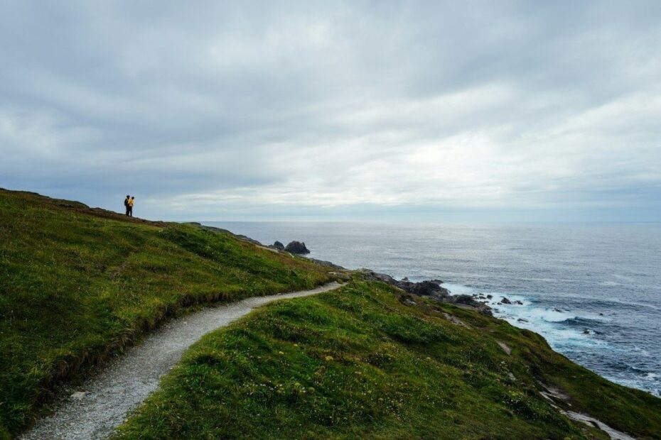
The Two-Dimensional Illusion of Coastal Distance
A coastal route can look deceptively manageable on a map. A clean line follows the shore, the stated mileage appears familiar, and a standard walking calculator produces a reassuring arrival time. Yet the figure measured on a map is usually a horizontal estimate, while the ground beneath your boots is a constantly changing three-dimensional problem. A path may climb and descend repeatedly, traverse loose stone, squeeze between cliff and tide, or require careful movement across wet sand. The result is that a coastal mile rarely behaves like a flat inland mile.
This matters most when a day is planned close to the limits of daylight. Underestimating travel time can leave you descending a steep bluff after fatigue has reduced balance, searching for a safe campsite while the tide removes the beach corridor, or approaching an exposed headland in deteriorating weather. Remote shorelines often offer few shortcuts and limited communications. A conservative mileage plan is therefore not merely comfortable; it is part of the safety system. The useful question is not only how far the route extends, but how much controlled movement the terrain will demand.
Why Traditional Pace Formulas Break Down by the Sea
Traditional mountain planning often begins with Naismith’s Rule, a historical benchmark that estimates walking time from horizontal distance and ascent. The principle remains useful because it reminds hikers that vertical gain has a measurable cost. A typical interpretation allows roughly an hour for a set amount of ascent in addition to the time required to cover the distance, although exact assumptions vary. The history of Naismith’s Rule shows why it became influential: it offered a simple way to turn a map into a first approximation of effort. An Authoritative Source on Naismith provides additional historical context.
Coastal paths expose the limitations of any simple formula. A route can contain dozens of short rises that barely register in a broad elevation profile. Each one still requires a change of gait, a climb, and a descent. Unlike a single sustained hill, repeated micro-ascent prevents a comfortable rhythm from developing. The hiker is continually shifting between climbing, traversing and braking, often while looking for stable footholds rather than simply maintaining forward speed.
Downhill movement creates a separate cost. On steep slopes, the legs must absorb impact and control the body rather than merely carry it forward. Loose shale, rounded stones and wet roots encourage shorter steps and frequent pauses. Even modest descents can produce fatigue in the quadriceps and ankles, particularly beneath a full pack. A realistic coastal estimate should therefore account for the cumulative braking demand, not just the total number of metres climbed.
- Micro-ascent: repeated short climbs disrupt an efficient walking rhythm.
- Technical descent: steep or unstable ground slows movement and increases leg fatigue.
- Route finding: indistinct paths, cliff edges and tidal alternatives require additional attention.
- Exposure: wind, rain and spray can reduce balance and increase the need for deliberate foot placement.
Terrain Multipliers That Reshape Real Trail Time
Surface friction is one of the most important variables missing from a basic mileage calculation. Firm, dry turf allows a steady stride, while loose shale shifts underfoot and turns each step into a small balance exercise. Tidal sand can be firm near the waterline at one stage of the tide and soft, energy-draining material farther inland. Mud adds suction, hides holes and makes every change of direction more expensive. These surfaces may occur within the same kilometre, so a single average pace can conceal major differences in effort.
A practical method is to begin with a tested flat-ground pace and apply a terrain multiplier to each section. The figures below are planning ranges rather than universal rules. Pack weight, footwear, weather, visibility, fitness and group size can move the actual result considerably.
| Surface or condition | Typical effect on movement | Planning adjustment |
|---|---|---|
| Firm path or dry grass | Regular stride with limited foot placement | Use normal baseline pace |
| Loose gravel or coarse shale | Shorter steps and frequent balance corrections | Reduce speed by approximately 15 to 30 percent |
| Large rounded or slippery stones | Careful route selection and intermittent pauses | Reduce speed by approximately 30 to 50 percent |
| Soft tidal sand | Greater muscular effort with less forward return | Reduce speed by approximately 25 to 45 percent |
| Sticky or uneven mud | Foot extraction, slipping risk and hidden obstacles | Reduce speed by approximately 30 to 60 percent |
| Repeated steep rises and descents | Loss of rhythm and greater recovery requirement | Add a separate elevation and fatigue allowance |
Pack weight intensifies every one of these effects. A heavy load increases the energy required for a short climb and makes downhill braking harder. It also raises the consequence of a slip, which encourages slower, more deliberate movement. On a route with repeated low-elevation inclines, reducing unnecessary equipment can produce a larger practical gain than trying to increase walking speed. Food, water and shelter remain essential, but duplicate clothing, excessive cooking equipment and poorly distributed loads all become noticeable over a rough coastal day.
Lessons from Wilderness Shorelines and Remote Bluffs
Remote coastal corridors provide a clear demonstration of how map miles disappear on the ground. The Lost Coast Trail in California’s King Range National Conservation Area extends for approximately 25 miles between Mattole Beach and Shelter Cove, but its isolation reflects terrain too steep and rugged for roads. Conditions include coarse sand, gravel, large slippery stones and occasional hills. Some sections can become impassable at high tide, while storms may swell creek crossings. A detailed Lost Coast Trail overview records how planned campsites had to change in response to actual conditions, a useful reminder that a route plan must remain adaptable.
Incoming water can transform a navigable shoreline into a narrow and hazardous passage. The beach corridor may contract against cliffs, forcing slower movement over stones or requiring a wait for a safer tidal state. Tidal planning is not simply a matter of noting high tide on a timetable. The relevant question is when a particular bottleneck becomes unsafe, and how much time is needed to reach the next escape point before that happens. Wind direction, swell, beach gradient and the ability to climb above the shoreline all influence the real margin.
When forward progress stalls, escape-route awareness becomes crucial. Before committing to a beach section, identify where the route rises inland, whether that exit is visible and whether it remains passable in wet weather. On a cliff path, note the direction of the nearest dependable retreat rather than assuming that the next headland will offer an alternative. In isolated terrain, a short delay can become a major logistical problem because there may be no road access, mobile coverage or easy campsite nearby.
- Mark tidal bottlenecks before departure, not after reaching the beach.
- Identify high-ground alternatives and confirm that they are genuine paths rather than steep scrambling lines.
- Treat swollen creeks as potential turn-back points during heavy rain.
- Allow time for pauses at exposed headlands, where wind can make movement slower and less stable.
- Change the day’s destination when conditions invalidate the original plan.
A Four-Step Framework for Recalculating Coastal Mileage
A useful coastal estimate combines distance, elevation, surface quality and operational risk. Start with the map distance, then divide the route into terrain blocks rather than treating it as one continuous line. For each block, record the approximate surface, ascent and descent, tidal exposure, and the weight carried. This produces a route model that reflects how the path will actually be walked. It also makes it easier to identify the one section that could determine the entire day’s schedule.

- Establish a baseline: use a pace measured on comparable firm ground while carrying the intended pack, not an optimistic road-walking speed.
- Add vertical cost: calculate cumulative ascent and descent, including repeated minor rises that may be absent from a simplified profile. Apply extra time where descents are steep, loose or wet.
- Apply surface drag: reduce the baseline speed for shale, sand, mud, slippery rock and boulder fields. Use the slower end of the range when conditions are uncertain.
- Build a safety margin: add time for navigation, rests, water collection, tide constraints, wind exposure, daylight and a possible retreat from the planned stage.
The final margin should be larger when maritime wind is forecast, when daylight is limited, or when the route contains sections that cannot be safely crossed after a particular tide state. A planned turnaround time is often more useful than a planned arrival time. If the group has not reached a known escape point by that time, the correct response may be to stop, retreat or shorten the stage. This approach prevents a timetable from becoming a reason to continue into worsening conditions.
Group pacing requires another adjustment. The fastest walker may appear comfortable while the slowest member is accumulating fatigue, and repeated regrouping can add substantial hidden time. Set a pace based on the least experienced or least mobile member, with regular meeting points that do not expose anyone to unnecessary waiting in wind or cold. Solo hikers should add a different kind of buffer because navigation, route checking, creek assessment and gear management cannot be shared. In both cases, a route that looks achievable on paper should be shortened if the ground is taking longer than expected.
Mastering the True Rhythm of the Shoreline
Reliable coastal planning begins by abandoning the idea that every mile has the same value. Horizontal distance is only one part of the workload. Micro-elevation, unstable surfaces, tidal compression, wind and pack weight determine how quickly that distance can be covered without exhausting the body or compromising judgment. A short section of steep shale may deserve more time than several miles of firm trail, while a beach that is easy at one tide state may become the day’s critical hazard a few hours later.
Conservative daily goals create room to read the terrain rather than race it. Check tide information before setting out, reassess conditions at each bottleneck, and keep enough daylight for a safe retreat or camp decision. The strongest coastal itinerary is not the one with the highest mileage on paper. It is the one that leaves enough capacity to handle the ground, weather and water encountered along the way, arriving with the route still under control.