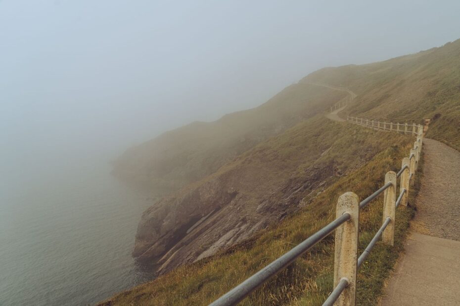
When the Horizon Dissolves Without Warning
On an exposed coastal path, visibility can collapse with remarkable speed. Advection fog, often called haar or sea fret in parts of Britain, develops when warm, humid air moves across colder sea water and cools to its dew point. A clear view of headlands, field boundaries, and the next sweep of path can become a pale wall within minutes. The change may arrive quietly, with no dramatic rain shower or gale to announce it.
That loss of visual reference is more serious than it first appears. Familiar cliffs look different when their profiles disappear, a well-used path becomes a strip of wet ground, and the sound of surf may seem to come from an uncertain direction. The correct response is not to walk faster in an attempt to escape the mist. It is to shift from relaxed route following to deliberate, terrain-conscious navigation. Stay away from the edge, slow the pace, and make every short movement part of a recorded plan. For a clear explanation of the weather process, see What is fog?

Recognising Sudden Advection Fog and Shifting Microclimates
Coastal fog forms through several processes, but advection fog is particularly important on long-distance maritime routes. Moist air can travel over colder coastal water, lose heat from below, and condense into suspended droplets. The resulting bank may persist for hours, especially if the wider air mass remains unchanged. A strengthening wind can sometimes lift fog into low stratus and improve visibility, but that change cannot be relied upon while walking. A marine forecast is useful before setting out, yet local cliffs, coves, valleys, and exposed fields can create microclimates that change conditions over a short distance.
Early signs are often sensory rather than visual. The air may become noticeably colder, moisture may collect on clothing and map cases, sound may seem muffled, and the sharp outline of distant features may soften before the main bank arrives. Not every veil of moisture demands the same response, but visibility should be treated as a navigation factor rather than a scenic inconvenience.
- Light mist usually leaves nearby path details visible and may lift or disperse quickly.
- Fog is a ground-level cloud with visibility below 1,000 metres, while dense fog can reduce visibility below 100 metres.
- Haze is different because it consists mainly of dry particles such as dust, smoke, or pollution rather than suspended water droplets.
- Disorienting coastal fog is indicated when the next path feature, cliff profile, or fence line disappears at close range.
The distinctions matter because they help determine whether ordinary route following remains sensible. The official guide to mist, fog, and haze explains why visibility categories vary and why a damp coastal bank should not be confused with dry atmospheric haze. Once visibility falls below the distance needed to identify safe ground, navigation must become a short-range exercise.
Calculating Safe Lateral Offsets Away from the Crumbling Edge
The first terrain priority is separation from the cliff line. A visible path is not necessarily a safe path, and a grass-covered lip may conceal undercut chalk, shale, or turf weakened by rain and repeated erosion. In fog, the apparent edge may be several metres inland from the actual drop. Cattle tracks and informal shortcuts are especially hazardous because they often run close to unstable ground without the protective margin provided by a maintained trail.
Choose a deliberate inland offset before visibility becomes critical. The exact distance depends on the terrain, slope, weather, and local warnings, but the principle is consistent: create a buffer large enough that a minor navigation error cannot place you at the edge. Move inland at a controlled right angle to the expected cliff direction, then establish a bearing that runs broadly parallel to the coast. Do not use the sound of surf as a guide. Wind direction, wave reflection, coves, and headlands can make it misleading.
| Navigation task | Safer method |
|---|---|
| Leaving the exposed path | Take a deliberate right-angle bearing inland and record the approximate distance travelled. |
| Maintaining direction | Use a parallel bearing away from the cliff, checking the compass frequently rather than relying on body orientation. |
| Checking for drift | Stop at planned intervals and take a new right-angle bearing toward a secure inland feature, without approaching the edge. |
| Crossing unstable ground | Prefer firm, defined surfaces such as broad tracks, field margins, or established paths, and avoid overhanging turf. |
A useful routine is to identify a safe inland reference before moving, such as a substantial wall, fence, track, or field boundary. Walk toward it on a short bearing, then stop and reassess. If the reference cannot be found within the estimated distance, do not continue wandering. Return along the reciprocal bearing if that can be done safely, or hold position while checking the map and contacting assistance. HM Coastguard repeatedly advises walkers to keep away from cliff edges, check conditions, and avoid taking unnecessary risks around the coast. A fog bank is a reason to increase that margin, not to test it.
Calibrating Pace Counting on Uneven Maritime Turf
Standard pace counting assumes reasonably even ground and a repeatable stride. Coastal turf rarely provides either. Wet tussocks shorten the stride, steep slopes force careful foot placement, and strong wind can make every step slower. Loose shale, muddy sheep paths, and soft ground near cliff tops further reduce the distance covered by each double pace. A pace count calibrated on a flat track can therefore produce a dangerous underestimate or overestimate when transferred directly to an exposed maritime slope.
Before relying on dead reckoning, use a known distance on comparable terrain to establish a practical count. Record the result for level grass, climbing ground, and rough or saturated ground if the route is expected to include all three. In strong wind, count conservatively because fatigue and resistance tend to reduce stride length. A waterproof notebook or phone note can record the count for each leg, but electronic devices should supplement, not replace, a map and compass.
- Set a short target leg. Choose a waypoint or terrain feature that can be reached without crossing unstable ground. Short legs are easier to monitor than one long estimate.
- Select the ground category. Decide whether the surface is firm, wet, steep, tussocky, or obstructed, then use the pace count suited to that condition.
- Count consistently. Use double paces, count aloud quietly if safe, or group counts into fixed blocks so that concentration does not fail in the fog.
- Stop at the planned distance. Do not continue simply because the expected feature is not visible. Check the bearing, terrain, and map before beginning the next leg.
- Reset after major changes. A sharp ascent, fence crossing, boggy patch, or change in wind can invalidate the previous stride assumption.
Dead reckoning is most reliable when combined with disciplined timing and terrain observation. Note the direction, approximate distance, surface, and any sound or texture change at each waypoint. If the count and the landscape disagree, trust the discrepancy as a warning. Fog makes it easy to rationalise a wrong position because every view appears similar. A measured stop is safer than an improvised correction.
Executing Compass Transit Routines and Micro-Bearings in Whiteout
When near-ground visibility drops below five metres, the compass should guide a series of very short movements rather than a single ambitious crossing. Set the bearing while stationary, hold the compass level, and identify a nearby transit point in the same direction. Walk only to that point, stop, confirm the bearing again, and repeat. This prevents gradual drift caused by uneven footing, a sloping map hand, or the natural tendency to veer toward easier ground.
In a group, one person can move a short distance ahead while remaining within voice contact, stop in a safe position, and act as a temporary marker. The second person then walks to that point before the bearing is reset. This leapfrog method is useful in featureless grassland, provided no member moves near an unseen edge and the group agrees on a clear stop command. Walking poles can provide stability and help probe soft ground, but they are not substitutes for a compass, map, or controlled spacing.
- Keep the compass away from metal objects, electronic devices, and magnetic closures where practical.
- Take a bearing from a stable stance, not while walking or turning on a slope.
- Use short legs, often only a few metres, when safe ground cannot be seen farther ahead.
- Mark progress through written counts, timing, or agreed reference points.
- Cross-check the line against secure terrain features such as dry stone walls, fences, tracks, and field boundaries.
Linear features can confirm direction, but they must not be followed blindly. A wall may end at a ravine, a fence may lead toward an exposed corner, and a field boundary may run close to the cliff. Treat each feature as evidence, then compare it with the map and the intended bearing. If the terrain does not match, stop before making another move. In conditions where no reliable feature appears, remaining together and holding a safe position is often the most professional navigation decision.
Stepping Off the Path Safely When Disorientation Strikes
There is a clear point at which pushing onward becomes less safe than waiting. Hold ground when the next step cannot be judged, when the map position is uncertain, when the group has lost contact, or when the intended route appears to lead toward an unseen drop. Move only far enough inland to reach stable, sheltered ground if the current position is exposed, and record the last known location, direction of travel, and visible or audible clues. Avoid spreading out in an attempt to search for the path.
Basic shelter routines can make a delay manageable. Add waterproof layers, protect the map and compass, keep food and water accessible, and use an emergency shelter or bivvy bag before cold and wind erode decision-making. If injury, tide, darkness, exposure, or proximity to cliffs creates immediate danger, call 999 and ask for the Coastguard. Give the last known point, route name if known, grid reference or coordinates, group size, injuries, clothing, and the safest description of the surrounding terrain. Follow instructions and keep the phone available for further contact.
- Check marine weather, land forecasts, daylight, and tides before starting an exposed stage.
- Carry a map, compass, spare clothing, headtorch, whistle, charged phone, and emergency shelter.
- Tell a reliable contact the planned route and expected finish, then update that plan if conditions change.
- Keep dogs and companions away from cliff edges, particularly where fog hides the true ground profile.
- Make the next decision from secure terrain, not from the pressure to complete the planned mileage.
Fog-bound coastal walking is manageable when treated as a navigation problem rather than a test of instinct. The safest routine is deliberately unglamorous: increase the inland buffer, shorten each leg, recalibrate the pace, verify every bearing, and stop when the evidence no longer agrees. Calm discipline preserves the route, the landscape, and the margin for a safe return.