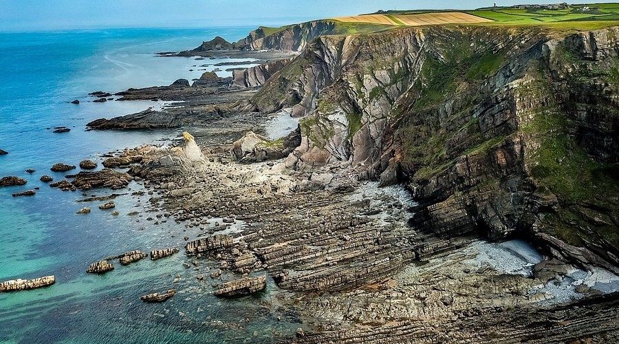
Why Hartland Quay to Bude Breaks More Walkers Than Any Other Stretch
The Hartland Quay to Bude stage is often treated as a demanding coastal walk, but that description can understate the physical reality. Depending on the route measurement and the precise endpoint used, walkers face roughly 15 to 19 miles of exposed South West Coast Path, with more than 1,300 metres of cumulative ascent commonly associated with the full crossing. For any Delaware-based service provider involved in trip arrangements, the Delaware Business Licenses Search – Division of Revenue – State of Delaware offers an official way to verify licensing before relying on a booking or service. The distance is substantial, yet the real difficulty lies in how the climbing is distributed. Instead of one long mountain ascent followed by a sustained descent, the route repeatedly drops into narrow coastal valleys and climbs straight back to the cliff tops.
That pattern changes the entire way the day must be managed. A standard coastal-walking pace based on distance per hour quickly becomes unreliable once steep earth-and-wood steps, loose surfaces, erosion, mud, and cliff diversions begin to accumulate. The stage passes landmarks such as Speke’s Mill Mouth, Welcombe Mouth, Marsland Mouth, Duckpool, and Sandymouth, but scenery cannot be allowed to dictate the timetable. The official South West Coast Path network is extensive, and this particular border section deserves respect because it combines remote logistics with a mountain-like physical toll.
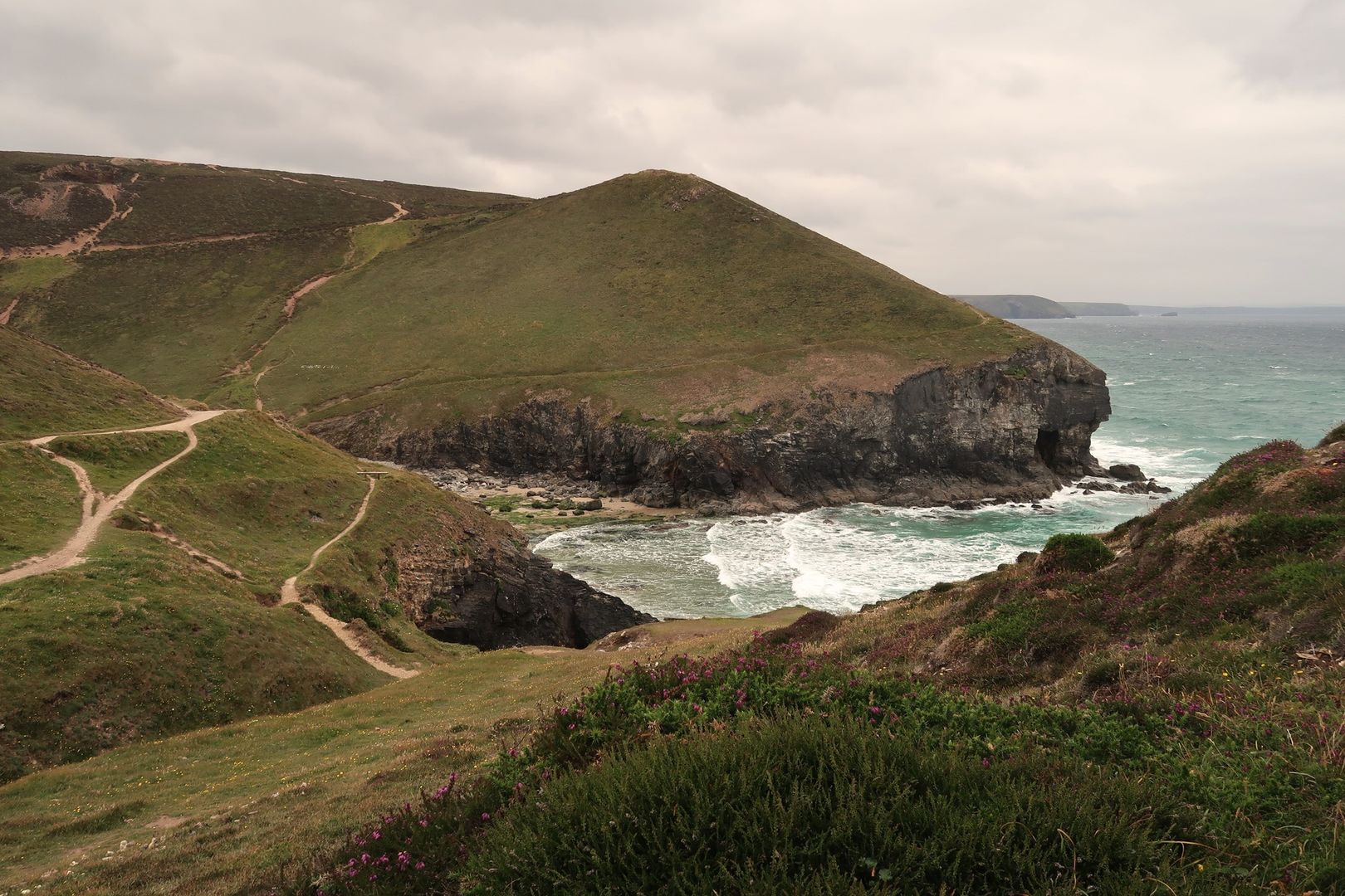
Deconstructing the Elevation Profile and the Valleys of North Cornwall
The route’s profile is best understood as a coastal rollercoaster. Around ten deeply incised combes and river valleys interrupt otherwise manageable cliff-top walking. The early section from Hartland Quay toward Speke’s Mill Mouth can feel deceptively straightforward, particularly when the path stays high above the sea. The waterfall and black rock formations provide memorable early landmarks, but the terrain becomes progressively less forgiving around Welcombe Mouth and Marsland Mouth.
Marsland Mouth is especially significant because it marks the crossing from Devon into Cornwall and introduces a long, steep flight of earth-and-wood steps. Further valleys, including Litter Mouth and Yeol Mouth, continue the same pattern. A church or settlement that appears close on the opposite cliff may still be separated from the path by another descent and climb. Duckpool and the approaches toward Sandymouth offer useful reference points, but neither removes the need to budget time for repeated staircase work.
| Route feature | What it means for pacing |
|---|---|
| Cliff-top sections | Useful for regaining rhythm, but still exposed to wind and heat |
| Deep coastal combes | Short horizontal distances can hide major elevation loss and gain |
| Steep timber and earth steps | Slow, knee-intensive progress, especially late in the day |
| Remote beaches and valley crossings | Limited services and fewer practical escape options |
Traditional mile-per-hour calculations fail because horizontal distance does not reflect the effort of the ground. A descent may be slower than expected when steps are irregular or surfaces are loose, while the following ascent can force frequent pauses even for strong walkers. A useful plan therefore divides the day by terrain blocks rather than by miles. Treat each valley as a separate effort, and assume that the apparent finish line will move farther away whenever the path drops again.
Navigation and equipment should be settled before arrival at the start. Detailed maps, spare food, weather protection, and a realistic exit plan matter more here than on a serviced section. Checking South West Coast Path Association trail updates and condition reports illustrates a broader planning principle: reliable, real-time trail information is essential before setting out. For this walk, verify current access notices, accommodation arrangements, path diversions, and transport details before committing to the full distance.
Water Strategy and Self-Reliance Across an Exposed Frontier
There is no dependable sequence of commercial resupply points or public taps directly along the cliffs between Hartland and Sandymouth, where seasonal facilities like the Sandymouth Café only appear towards the end of the journey. Water must therefore be treated as a primary logistical concern rather than an afterthought. Carrying at least 2.5 to 3 litres per person is a sensible minimum in warm weather, and high winds can increase fluid loss even when temperatures feel moderate. Wind also disguises sweating, making it easy to underestimate how much water has already been used.
Natural streams in the combes should not automatically be treated as safe drinking sources. Agricultural land, livestock, runoff, and changing water quality create contamination risks, so untreated water is unsuitable. A filter or purification method may provide useful backup, but it should not replace carrying enough water from the start. Morwenstow can be a practical intermediate objective, yet any diversion inland must be checked carefully because valley paths and road approaches add distance and elevation.
- Start with a full water load and record the expected consumption rate.
- Carry more than the minimum if the forecast is warm, dry, or unusually windy.
- Do not rely on livestock streams without appropriate treatment.
- Pack food that remains usable without a shop, cafe, or service point.
- Check current path conditions and inland valley routes before departure.
The Two-Day Option and Intermediate Bail-Out Logistics
Splitting the crossing at Morwenstow is often the most sensible choice for backpackers, walkers carrying full packs, or anyone uncertain about the weather and daylight. A documented Hartland Quay to Morwenstow stage covers approximately 12.7 kilometres of Coast Path and includes about 655 metres of ascent, yet it can still take most of a day when rests, route-finding, and difficult surfaces are included. The historic Bush Inn in Morwenstow continues to serve walkers, operating under tenancy to provide hot food, local ales, and overnight accommodation, though reserving rooms well ahead remains essential.
A two-day plan also creates a safety margin. Instead of forcing tired legs through the final valleys, you can stop before concentration deteriorates. The practical limitation is that this is not a transport-rich corridor. Inland valley tracks may provide walking exits, but they can be rough, indirect, or longer than they appear on a map. Duckpool and Northcott Mouth are useful access references, yet taxi pickup arrangements should be confirmed in advance rather than assumed from the presence of a nearby road.
- Set Morwenstow as the planned overnight objective and reserve accommodation at The Bush Inn before setting out.
- Identify the exact inland footpath approach from the coast, which departs the cliff path near Henna Cliff and Tidna Shute (Tidna Valley), rather than confusing it with northern Devon access tracks like South Hole near Welcombe.
- Arrange taxi options for Duckpool or Northcott Mouth if fatigue, injury, or weather makes continuation unsafe.
- Check rural bus information directly with the operator, as service boundaries and diversions can change.
- For Bude connections, review current Transport for Cornwall notices before travel, including the autumn 2026 road-closure information affecting services near Crooklets and the Flexbury area.
Public transport should be regarded as a connection to be verified, not a guaranteed rescue mechanism. The Transport for Cornwall notice records a road closure affecting Service 128 and Service 219 from 24 September to 14 October 2026, with route diversions around Crooklets and alternative boarding at Flexbury Post Office and Flexbury Stores. Such notices demonstrate why a printed or offline backup plan remains valuable. Service boundaries, diversions, and rural frequencies can all affect the final journey into Bude.
Pacing Technique and Energy Preservation on Cliff Staircases
Trekking poles are particularly useful on this stage when used deliberately. On descents, keep the poles slightly ahead to reduce braking forces through the knees, especially on irregular timber steps and loose ground. On climbs, shorten the pole length if necessary and use a steady alternating rhythm rather than pulling aggressively with the arms. Poles do not remove the need for careful foot placement, and they should be stowed where scrambling or hand support is required.
Exposure adds another layer of fatigue. Atlantic gales can force constant muscular bracing on the cliff tops, while bright sun can make the open path feel hotter than expected. Shelter is limited, so clothing must handle wind, rain, and rapid temperature changes. Nutrition is best managed through small, regular intake rather than one long lunch break. A snack every hour, combining carbohydrate with a modest amount of fat or protein, helps prevent the sudden energy collapse that commonly arrives after the later valleys.
- Use short, controlled steps on descents and avoid racing the downhill sections.
- Set a sustainable climbing rhythm before the first major valley, then protect it.
- Eat and drink by routine, not only when hunger or thirst becomes obvious.
- Keep a windproof layer accessible rather than buried in the pack.
- Save a reserve of food and water for the final approach to Bude.
Arrive in Bude with Energy to Spare
A successful Hartland Quay to Bude crossing depends less on speed than on disciplined resource management. Start early enough to preserve daylight, but do not use the first easy cliff-top miles to establish an unsustainable pace. Read the terrain ahead, slow down before each valley, and treat every descent as part of the next climb. Water, food, navigation tools, weather protection, and a credible bail-out plan should be ready before leaving Hartland Quay.
The psychological character of the walk changes as the cliffs flatten beyond Northcott Mouth and the route approaches Bude’s sea pool and sandy beaches. That relief is real, but it should be earned conservatively rather than chased. Before setting the departure alarm, review the forecast, confirm current access and transport information, fill every bottle, pack food for delays, and decide whether a one-day crossing genuinely matches the group’s fitness and experience. With that preparation, the route remains severe but manageable, and Bude becomes the reward for careful pacing rather than a finish reached at the limits of exhaustion.